Wahpeton, Iowa
| Wahpeton | |
| city | |
| Land |  USA USA |
|---|---|
| Delstat | Iowa |
| County | Dickinson County |
| Koordinater | 43°22′27″N 95°10′28″V / 43.37417°N 95.17444°V / 43.37417; -95.17444 |
| Yta | 3,2 km² (2010)[1] |
| - land | 3,1 km² |
| - vatten | 0,1 km² |
| Folkmängd | 346 (2011)[2] |
| Befolkningstäthet | 112 invånare/km² |
| Tidszon | CST (UTC-6) |
| - sommartid | CDT (UTC-5) |
| ZIP-kod | 51351, 51360[3] |
| FIPS | 1981615 |
| Geonames | 4880416 |
  Ortens läge i Iowa | |
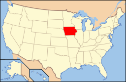 Iowas läge i USA | |
Wahpeton är en ort i Dickinson County i den amerikanska delstaten Iowa med en folkmängd som uppgår till 462 invånare (2000). Den har enligt United States Census Bureau en area på 3,4 km².
Källor
- ^ ”2010 Census Gazetteer Files”. US Census Bureau. Arkiverad från originalet den 14 juli 2012. https://www.webcitation.org/699nOulzi?url=http://www.census.gov/geo/www/gazetteer/files/Gaz_places_national.txt. Läst 14 juli 2012.
- ^ ”Annual Estimates of the Resident Population for Incorporated Places: April 1, 2010 to July 1, 2011”. Arkiverad från originalet den 15 augusti 2012. https://www.webcitation.org/69wGjHAkI?url=http://www.census.gov/popest/data/cities/totals/2011/tables/SUB-EST2011-03-19.csv. Läst 15 augusti 2012.
- ^ ”2010 ZIP Code Tabulation Area (ZCTA) Relationship Files”. U.S. Census Bureau. 11 september 2010. Arkiverad från originalet den 25 augusti 2012. https://www.webcitation.org/6ABdwXxbq?url=http://www.census.gov/geo/www/2010census/zcta_rel/zcta_place_rel_10.txt. Läst 25 augusti 2012.


