Arrondissement Confolens
| Arrondissement Confolens | |
|---|---|
| Geografie | |
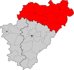 Arrondissement Confolens na mapě departementu Charente | |
| Hlavní město | Confolens |
| Souřadnice | 46°1′ s. š., 0°40′ v. d. |
| Rozloha | 2 268 km² |
| Geodata (OSM) | OSM, WMF |
| Obyvatelstvo | |
| Počet obyvatel | 64 651 (2007) |
| Hustota zalidnění | 28,5 obyv./km² |
| Správa regionu | |
| Stát | Francie Francie Francie |
| Region | Poitou-Charentes |
| Departement | Charente |
| Druh celku | Arrondissement |
| Podřízené celky | Kantony: 10 Obce: 139 |
| Některá data mohou pocházet z datové položky. | |
Arrondissement Confolens je francouzský arrondissement ležící v departementu Charente v regionu Poitou-Charentes. Člení se dále na 10 kantonů a 139 obcí.
Kantony
- Aigre
- Chabanais
- Champagne-Mouton
- Confolens-Nord
- Confolens-Sud
- Mansle
- Montembœuf
- Ruffec
- Saint-Claud
- Villefagnan
 | Tento článek je příliš stručný nebo postrádá důležité informace. Pomozte Wikipedii tím, že jej vhodně rozšíříte. Nevkládejte však bez oprávnění cizí texty. |
| Arrondissementy v regionu Nová Akvitánie | ||
|---|---|---|
| Agen • Angoulême • Arcachon • Aubusson • Bayonne • Bellac • Bergerac • Blaye • Bordeaux • Bressuire • Brive-la-Gaillarde • Châtellerault • Cognac • Confolens •Dax • Guéret • Jonzac • Langon • Lesparre-Médoc • Libourne • Limoges • Marmande • Mont-de-Marsan • Montmorillon • Nérac • Niort • Nontron • Oloron-Sainte-Marie • Parthenay • Pau • Périgueux • Poitiers • Rochechouart • La Rochelle • Rochefort • Saint-Jean-d'Angély • Saintes • Sarlat-la-Canéda • Tulle • Ussel • Villeneuve-sur-Lot |    | |
Portály: Francie


