Chimaltenango Department
Department of Guatemala
You can help expand this article with text translated from the corresponding article in Spanish. (December 2008) Click [show] for important translation instructions.
- View a machine-translated version of the Spanish article.
- Machine translation, like DeepL or Google Translate, is a useful starting point for translations, but translators must revise errors as necessary and confirm that the translation is accurate, rather than simply copy-pasting machine-translated text into the English Wikipedia.
- Do not translate text that appears unreliable or low-quality. If possible, verify the text with references provided in the foreign-language article.
- You must provide copyright attribution in the edit summary accompanying your translation by providing an interlanguage link to the source of your translation. A model attribution edit summary is
Content in this edit is translated from the existing Spanish Wikipedia article at [[:es:Chimaltenango (departamento)]]; see its history for attribution. - You may also add the template
{{Translated|es|Chimaltenango (departamento)}}to the talk page. - For more guidance, see Wikipedia:Translation.
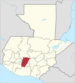
Department of Guatemala in Chimaltenango
Chimaltenango Department Departmento de Chimaltenango | |
|---|---|
Department of Guatemala | |
 Counterclockwise from top: English: Mixco Viejo Ruins in San Martín Jilotepeque, Castle in Chimaltenango, Iximche Ruins in Tecpan, Madrean pine–oak woodlands in Chimaltenango, Acatenango volcano in Acatenango, Hacienda Real in Tecpan | |
 Flag  Seal | |
 Chimaltenango | |
| Country |  Guatemala Guatemala |
| Department | Chimaltenango |
| Capital | Chimaltenango |
| Municipalities | 16 |
| Government | |
| • Type | Departmental |
| Area | |
| • Department of Guatemala | 1,979 km2 (764 sq mi) |
| Population (2018)[1] | |
| • Department of Guatemala | 615,776 |
| • Density | 310/km2 (810/sq mi) |
| • Urban | 333,300 |
| • Religions | Roman Catholicism Evangelicalism Maya |
| Time zone | UTC-6 |
Chimaltenango is a department of Guatemala. The capital is Chimaltenango.
Geography
Located to the east are Guatemala Department, home to Guatemala City, and Sacatepéquez Department, while also bordered by Quiché Department and Baja Verapaz Department to the north, Escuintla Department and Suchitepéquez Department to the south, and Sololá Department to the west. The capital of Chimaltenango is located about 54 kilometers away from Guatemala City.
In addition to the city of Chimaltenango, the department contains the towns of Santa Apolonia (known for its ceramics), San Juan Comalapa, and Patzún (known for its elaborate Corpus Christi celebrations in June). Chimaltenango is also home to the Maya civilization ruins of Iximché and Mixco Viejo, in addition to many smaller sites.
Demographics
As of the 2018 census, the population of Chimaltenango department was 615,776.[1] The majority of the people in the department are of Cakchiquel Maya descent. The department has an area of 1,979 km².
There are several humanitarian aid groups that provide services in Chimaltenango.
Municipalities
- Acatenango
- Chimaltenango
- El Tejar
- Parramos
- Patzicía
- Patzún
- Pochuta
- San Andrés Itzapa
- San José Poaquil
- San Juan Comalapa
- San Martín Jilotepeque
- Santa Apolonia
- Santa Cruz Balanyá
- Tecpán Guatemala
- Yepocapa
- Zaragoza
The department abbreviation is CMT.
References
- ^ a b Citypopulation.de Population of departments in Guatemala
External links
- CHIMALTENANGO
- Interactive department map
- v
- t
- e

| Authority control databases: Geographic |
|
|---|
14°33′48″N 90°58′55″W / 14.563316°N 90.982067°W / 14.563316; -90.982067


