Cross Road, Adelaide
Arterial road in Adelaide, South Australia


West end
East end
- 34°58′06″S 138°32′53″E / 34.968305°S 138.548139°E / -34.968305; 138.548139 (West end)
- 34°57′48″S 138°38′38″E / 34.963395°S 138.644001°E / -34.963395; 138.644001 (East end)
 A3 (1998–present)
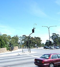
Plympton, Adelaide
 Anzac Highway
 Marion Road
 South Road
 Portrush Road
 Glen Osmond Road


 South Eastern Freeway
Glen Osmond, Adelaide
Cross Road is a major arterial road that travels east–west through the inner southern suburbs of the Australian city of Adelaide.[3] It is designated route A3.
Route
Cross Road starts at the intersection at Anzac Highway in Plympton and heads directly east, crossing the Glenelg tram line shortly after, then crossing the Flinders railway line and Seaford railway line at Emerson Crossing under the South Road underpass, and the Belair and Adelaide-Wolseley railway lines in Unley Park. It continues east through Highgate and eventually ends at Glen Osmond and the Adelaide Hills, at the junction of Glen Osmond Road, Portrush Road, and South Eastern Freeway.
History
In a 1949 street directory, Cross Road had its current route, but was named "Cross Roads" (plural) and is shown as the aggregation of a number of local street names including:[4]
- High Terrace (between Fullarton and Unley Roads)
- Napier Terrace (Between Unley and Goodwood Roads)
- South Terrace (between Goodwood and South Roads)
- Glen Osmond Road (between South and Marion Roads)
- Plympton Terrace (between Marion Road and Anzac Highway)
Major intersections


References
- ^ a b c "Cross Road" (Map). Google Maps. Retrieved 29 June 2022.
- ^ "Location SA Map viewer with regional layers". Government of South Australia. Retrieved 16 June 2022.
- ^ 2003 Adelaide Street Directory, 41st Edition. UBD (A Division of Universal Press Pty Ltd). 2003. ISBN 0-7319-1441-4.
- ^ "Gregory's Street Directory of Adelaide and Suburbs" (1949 ed.). Retrieved 10 July 2016 – via OpenStreetMap Australia.
- ^ "Location SA Map viewer with LGA layers". Government of South Australia. Retrieved 16 June 2022.
- ^ "Location SA Map viewer with suburb layers". Government of South Australia. Retrieved 16 June 2022.
- v
- t
- e
 Road infrastructure in Adelaide


- Anzac Highway
- Adelaide–Mannum Road (North East Road)
- Gawler Bypass
- Glen Osmond Road
- Grand Junction Road
- Main North Road
- Main South Road
- Mount Barker Road
- Port Road
- Port Wakefield Road
- Portrush/Lower Portrush/Ascot/Taunton/Hampstead Roads
- Salisbury Highway
- Sir Donald Bradman Drive
- South Road
- Victor Harbor Road
- Churchill Road
- City Ring Route
- Cross Road
- Daws Road
- Elder Smith Road
- Flagstaff Road
- Fullarton Road
- Goodwood Road
- Grange Road
- Greenhill Road
- Henley Beach Road
- Kensington Road
- McIntyre/King Roads
- Magill Road
- Marion Road
- Melbourne Street
- Montacute Road
- Montague Road
- O'Connell Street
- Panalatinga Road
- Payneham/Lower North East Roads
- Philip Highway
- Prospect Road
- Regency/Muller Roads
- Tapleys Hill/Brighton/Ocean/Lonsdale/Dyson/Murray Roads
- The Parade
- Torrens Road
- Unley Road
- Victoria Road
- Angas Street
- East Terrace
- Carrington Street
- Currie Street
- Flinders Street
- Franklin Street
- Gawler Place
- Gilbert Street
- Gilles Street
- Gouger Street
- Grenfell Street
- Grote Street
- Halifax Street
- Hindley Street
- Jeffcott Street
- King William Street
- Morphett Street
- North Terrace
- Pirie Street
- Pulteney Street
- Rundle Mall
- Rundle Street
- South Terrace
- Sturt Street
- Wakefield Street
- Waymouth Street
- West Terrace
- Wright Street


