Daws Road
Street in Adelaide, South Australia
Daws Road South Australia | |
|---|---|
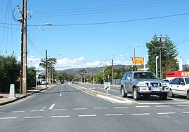 | |
| Daws Road, looking east from the South Road intersection | |
| Coordinates |
|
| General information | |
| Type | Road |
| Location | Adelaide |
| Length | 3.3 km (2.1 mi)[1] |
| Major junctions | |
| West end | Oaklands Road Ascot Park, Adelaide |
| |
| East end | Springbank Road Daw Park, Adelaide |
| Location(s) | |
| Region | Southern Adelaide[2] |
| Major suburbs | Edwardstown, Melrose Park |
Daws Road is a major arterial road in the central southern suburbs of Adelaide. It runs east–west between Marion Road in the west and Goodwood Road in the east.[3] Pasadena High School and the Repatriation Hospital are on Daws Road.
Route
Daws Road starts at the intersection with Oaklands Road and Marion Road in Ascot Park. It heads east as a four-lane, dual-carriageway road. It goes underneath the railway bridges of the Seaford railway line, then crosses the Flinders railway line a short distance further east. It continues east to cross South Road. It ends at the intersection with Goodwood and Springbank Roads in Daw Park.
History
The section of Daws Road west of South Road was previously known as Sweetmans Road, with the road ending at Railway Terrace, Ascot Park.
In 2019, the government proposed to realign the intersection of Daws and Goodwood Roads to create a new four-way intersection, eliminating the dogleg and improving traffic flow between them.[4] Construction started in January 2021 and was completed four months later in April 2021,[5] for a cost of $61 million. Half was funded by the South Australian government and half by the Federal government.[6]
Public transport
The road is serviced by the 241 bus between Marion Road and West Street (Ascot Park). The 213 bus runs between Beaumont Street (Clovelly Park) and Goodwood Road. The 297 bus travels from Beaumont Street to Winston Avenue (Melrose Park).
Major intersections
| LGA[7] | Location[1][8] | km[1] | mi | Destinations | Notes |
|---|---|---|---|---|---|
| Marion | Park Holme–Ascot Park boundary | 0.0 | 0.0 | Oaklands Road – Somerton Park | Western terminus of road |
 Marion Road (A14) – Brooklyn Park, Plympton, Darlington Marion Road (A14) – Brooklyn Park, Plympton, Darlington | |||||
| Ascot Park–Mitchell Park boundary | Seaford railway line | ||||
| Flinders railway line | |||||
| Marion–Mitcham boundary | Edwardstown–Clovelly Park–Melrose Park–St Marys quadripoint |  South Road (A2) – Hindmarsh, St Marys South Road (A2) – Hindmarsh, St Marys | |||
| Mitcham | Daw Park–Pasadena boundary |  Oxford Circus – Repat Health Precinct Oxford Circus – Repat Health Precinct | |||
| Daw Park–Panorama boundary | 3.3 | 2.1 | Goodwood Road – Wayville, Goodwood | ||
| Springbank Road – Clapham | Eastern terminus of road | ||||
| |||||
References
- ^ a b c "Daws Road" (Map). Google Maps. Retrieved 1 July 2022.
- ^ "Location SA Map viewer with regional layers". Government of South Australia. Retrieved 16 June 2022.
- ^ 2003 Adelaide Street Directory, 41st Edition. UBD (A Division of Universal Press Pty Ltd). 2003. ISBN 0-7319-1441-4.
- ^ Wills, Daniel (6 May 2019). "Minister accused of 'embarrassing backflip' as new plans are released to eliminate Springbank Rd dog-leg". The Advertiser. Retrieved 10 December 2019.
- ^ "Goodwood, Springbank and Daws Road Intersection Upgrade". Department of Infrastructure and Transport. Retrieved 1 July 2022.
- ^ "Goodwood, Springbank and Daws Road Intersection Upgrade". Infrastructure Australia. Retrieved 1 July 2022.
- ^ "Location SA Map viewer with LGA layers". Government of South Australia. Retrieved 16 June 2022.
- ^ "Location SA Map viewer with suburb layers". Government of South Australia. Retrieved 16 June 2022.
- v
- t
- e
 Road infrastructure in Adelaide


- Anzac Highway
- Adelaide–Mannum Road (North East Road)
- Gawler Bypass
- Glen Osmond Road
- Grand Junction Road
- Main North Road
- Main South Road
- Mount Barker Road
- Port Road
- Port Wakefield Road
- Portrush/Lower Portrush/Ascot/Taunton/Hampstead Roads
- Salisbury Highway
- Sir Donald Bradman Drive
- South Road
- Victor Harbor Road
- Churchill Road
- City Ring Route
- Cross Road
- Daws Road
- Elder Smith Road
- Flagstaff Road
- Fullarton Road
- Goodwood Road
- Grange Road
- Greenhill Road
- Henley Beach Road
- Kensington Road
- McIntyre/King Roads
- Magill Road
- Marion Road
- Melbourne Street
- Montacute Road
- Montague Road
- O'Connell Street
- Panalatinga Road
- Payneham/Lower North East Roads
- Philip Highway
- Prospect Road
- Regency/Muller Roads
- Tapleys Hill/Brighton/Ocean/Lonsdale/Dyson/Murray Roads
- The Parade
- Torrens Road
- Unley Road
- Victoria Road
- Angas Street
- East Terrace
- Carrington Street
- Currie Street
- Flinders Street
- Franklin Street
- Gawler Place
- Gilbert Street
- Gilles Street
- Gouger Street
- Grenfell Street
- Grote Street
- Halifax Street
- Hindley Street
- Jeffcott Street
- King William Street
- Morphett Street
- North Terrace
- Pirie Street
- Pulteney Street
- Rundle Mall
- Rundle Street
- South Terrace
- Sturt Street
- Wakefield Street
- Waymouth Street
- West Terrace
- Wright Street


