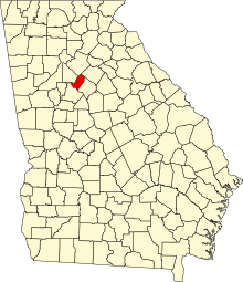
National Register of Historic Places listings in Rockdale County, Georgia
This is a list of properties and districts in Rockdale County, Georgia that are listed on the National Register of Historic Places (NRHP).
Map all coordinates using OpenStreetMap
Download coordinates as:
- KML
- GPX (all coordinates)
- GPX (primary coordinates)
- GPX (secondary coordinates)
This National Park Service list is complete through NPS recent listings posted June 21, 2024.[1]
- v
- t
- e
Properties on the National Register of Historic Places in Georgia by county
- Appling
- Atkinson
- Bacon
- Baker
- Baldwin
- Banks
- Barrow
- Bartow
- Ben Hill
- Berrien
- Bibb
- Bleckley
- Brantley
- Brooks
- Bryan
- Bulloch
- Burke
- Butts
- Calhoun
- Camden
- Candler
- Carroll
- Catoosa
- Charlton
- Chatham
- Chattahoochee
- Chattooga
- Cherokee
- Clarke
- Clay
- Clayton
- Clinch
- Cobb
- Coffee
- Colquitt
- Columbia
- Cook
- Coweta
- Crawford
- Crisp
- Dade
- Dawson
- Decatur
- DeKalb
- Dodge
- Dooly
- Dougherty
- Douglas
- Early
- Echols
- Effingham
- Elbert
- Emanuel
- Evans
- Fannin
- Fayette
- Floyd
- Forsyth
- Franklin
- Fulton
- Gilmer
- Glascock
- Glynn
- Gordon
- Grady
- Greene
- Gwinnett
- Habersham
- Hall
- Hancock
- Haralson
- Harris
- Hart
- Heard
- Henry
- Houston
- Irwin
- Jackson
- Jasper
- Jeff Davis
- Jefferson
- Jenkins
- Johnson
- Jones
- Lamar
- Lanier
- Laurens
- Lee
- Liberty
- Lincoln
- Long
- Lowndes
- Lumpkin
- Macon
- Madison
- Marion
- McDuffie
- McIntosh
- Meriwether
- Miller
- Mitchell
- Monroe
- Montgomery
- Morgan
- Murray
- Muscogee
- Newton
- Oconee
- Oglethorpe
- Paulding
- Peach
- Pickens
- Pierce
- Pike
- Polk
- Pulaski
- Putnam
- Quitman
- Rabun
- Randolph
- Richmond
- Rockdale
- Schley
- Screven
- Seminole
- Spalding
- Stephens
- Stewart
- Sumter
- Talbot
- Taliaferro
- Tattnall
- Taylor
- Telfair
- Terrell
- Thomas
- Tift
- Toombs
- Towns
- Treutlen
- Troup
- Turner
- Twiggs
- Union
- Upson
- Walker
- Walton
- Ware
- Warren
- Washington
- Wayne
- Webster
- Wheeler
- White
- Whitfield
- Wilcox
- Wilkes
- Wilkinson
- Worth

Current listings
| [2] | Name on the Register | Image | Date listed[3] | Location | City or town | Description |
|---|---|---|---|---|---|---|
| 1 | Almand-O'Kelley-Walker House |  | February 2, 1998 (#97001647) | 981 Green St. 33°39′50″N 84°00′56″W / 33.66387°N 84.01563°W / 33.66387; -84.01563 (Almand-O'Kelley-Walker House) | Conyers | |
| 2 | Conyers Commercial Historic District |  | May 24, 1988 (#88000581) | Roughly bounded by N. Main St., Warehouse St., GA RR, and Center St. 33°40′01″N 84°01′04″W / 33.666944°N 84.017778°W / 33.666944; -84.017778 (Conyers Commercial Historic District) | Conyers | |
| 3 | Conyers Residential Historic District |  | July 5, 1990 (#90000947) | NW of the central business district, roughly along Main St., Milstead Ave., and Railroad St. 33°40′15″N 84°01′13″W / 33.670833°N 84.020278°W / 33.670833; -84.020278 (Conyers Residential Historic District) | Conyers | |
| 4 | Dial Mill |  | April 6, 1978 (#78001005) | NE of Conyers off GA 138 33°42′42″N 83°54′51″W / 33.71158°N 83.91426°W / 33.71158; -83.91426 (Dial Mill) | Conyers | |
| 5 | Fountain Hill | Upload image | February 20, 2024 (#100009953) | Address Restricted | Conyers vicinity | |
| 6 | Aaron and Margaret Parker Jr. House |  | May 6, 2009 (#09000271) | 4835 Flat Bridge Rd., SW. 33°37′54″N 84°08′43″W / 33.63177°N 84.14533°W / 33.63177; -84.14533 (Aaron and Margaret Parker Jr. House) | Stockbridge | Now in the Panola Mountain State Preservation Park |
| 7 | Rockdale County Jail |  | August 26, 1982 (#82002462) | 967 Milstead Ave. 33°40′07″N 84°01′00″W / 33.66861°N 84.01677°W / 33.66861; -84.01677 (Rockdale County Jail) | Conyers | Now the Old Jail Museum |
References
- ^ National Park Service, United States Department of the Interior, "National Register of Historic Places: Weekly List Actions", retrieved June 21, 2024.
- ^ Numbers represent an alphabetical ordering by significant words. Various colorings, defined here, differentiate National Historic Landmarks and historic districts from other NRHP buildings, structures, sites or objects.
- ^ The eight-digit number below each date is the number assigned to each location in the National Register Information System database, which can be viewed by clicking the number.
Wikimedia Commons has media related to National Register of Historic Places in Rockdale County, Georgia.


