Ponta da Fragata
16°38′42″N 22°53′8″W / 16.64500°N 22.88556°W / 16.64500; -22.88556Location Eastern Sal, Cape Verde Offshore water bodies Atlantic Ocean Integral Nature Reserves Nature Reserves Natural Parks Natural Monuments Protected Landscapes Ramsar sites
Ponta da Fragata (Portuguese meaning "tip of the frigate") is a headland on the east coast of the island of Sal, Cape Verde. It is situated at the southern end of the Serra Negra mountain, 6 km northeast of the town Santa Maria. To the south of the headland stretches the Costa da Fragata, a 4.7 km long sandy beach which is a protected nature reserve, important as nesting area for loggerhead sea turtles.[1] The nature reserve covers 3.46 km2 (1.34 sq mi) of land and 23.47 km2 (9.06 sq mi) of ocean.[2]
See also
References
- v
- t
- e
- Santa Luzia, Ilhéu Raso and Ilhéu Branco
- Ilhéu de Baluarte
- Ilhéu de Curral Velho
- Ilhéu dos Pássaros
- Ilhéus do Rombo
- Cruzinha
- Alto das Cabaças
- Costa da Fragata
- Ponta do Sinó
- Rabo de Junco
- Serra Negra
- Baía da Murdeira
- Boa Esperança
- Morro de Areia
- Ponta do Sol
- Tartaruga
- Casas Velhas
- Lagoa Cimidor
- Praia do Morro
- Terras Salgadas
- Cova-Paul-Ribeira da Torre Natural Park
- Moroços
- Tope de Coroa
- Monte Verde
- Monte Gordo
- Norte (Boa Vista)
- Serra do Pico de Antónia
- Serra Malagueta
- Fogo Natural Park
- Barreiro-Figueira
- Morrinho de Açúcar
- Morrinho do Filho
- Monte Estância
- Monte Santo António
- Rocha Estância
- Ilhéu de Sal Rei
- Pombas
- Monte Grande
- Buracona-Ragona
- Pedra de Lume salt ponds and Cagarral
- Santa Maria salt ponds
- Monte Caçador and Pico Forcado
- Curral Velho
- Monte Penoso and Monte Branco
- Monte Santo António (Maio)
- Porto Inglês salt flats
The island of Sal, Cape Verde | ||
|---|---|---|
| Settlements | 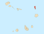 | |
| Mountains and hills |
| |
| Points and promontories |
| |
| Lighthouses | ||
| Other geographical features | ||
| Other topics | ||


