List of listed buildings in Colvend and Southwick
This is a list of listed buildings in the parish of Colvend and Southwick, Dumfries and Galloway, Scotland.
Map all coordinates using OpenStreetMap
Download coordinates as:
- KML
- GPX (all coordinates)
- GPX (primary coordinates)
- GPX (secondary coordinates)
List
| Name | Location | Date Listed | Grid Ref. [note 1] | Geo-coordinates | Notes | LB Number [note 2] | Image |
|---|---|---|---|---|---|---|---|
| Kipp Lodge | 54°53′03″N 3°48′24″W / 54.884265°N 3.806804°W / 54.884265; -3.806804 (Kipp Lodge) | Category C(S) | 3718 |  Upload Photo | |||
| Auchenskeoch Castle | 54°54′46″N 3°41′25″W / 54.912789°N 3.690264°W / 54.912789; -3.690264 (Auchenskeoch Castle) | Category B | 3709 | Upload Photo | |||
| Drumstinchall | 54°54′15″N 3°44′29″W / 54.90422°N 3.741439°W / 54.90422; -3.741439 (Drumstinchall) | Category B | 3713 | Upload Photo | |||
| Shawfoot Cottage, Caulkerbush | 54°53′53″N 3°40′35″W / 54.898062°N 3.676345°W / 54.898062; -3.676345 (Shawfoot Cottage, Caulkerbush) | Category B | 3721 | Upload Photo | |||
| Barnhourie Mill | 54°52′49″N 3°43′54″W / 54.880245°N 3.731707°W / 54.880245; -3.731707 (Barnhourie Mill) | Category B | 3710 | Upload Photo | |||
| Southwick Home Farm | 54°53′45″N 3°39′34″W / 54.89575°N 3.659532°W / 54.89575; -3.659532 (Southwick Home Farm) | Category A | 3723 | 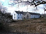 Upload another image | |||
| Southwick House | 54°54′01″N 3°40′11″W / 54.900382°N 3.669766°W / 54.900382; -3.669766 (Southwick House) | Category B | 3724 | Upload Photo | |||
| Fairgirth House | 54°53′28″N 3°44′57″W / 54.891051°N 3.749073°W / 54.891051; -3.749073 (Fairgirth House) | Category B | 3700 | Upload Photo | |||
| Kipp House | 54°53′00″N 3°48′19″W / 54.88331°N 3.805156°W / 54.88331; -3.805156 (Kipp House) | Category B | 3702 | Upload Photo | |||
| Saltflats, Rockcliffe | 54°51′57″N 3°47′54″W / 54.865775°N 3.798435°W / 54.865775; -3.798435 (Saltflats, Rockcliffe) | Category C(S) | 3720 | Upload Photo | |||
| Southwick Parish Church (Church Of Scotland) | 54°53′58″N 3°40′27″W / 54.89953°N 3.674238°W / 54.89953; -3.674238 (Southwick Parish Church (Church Of Scotland)) | Category B | 1646 |  Upload another image | |||
| Colvend Church, Church Of Scotland, And Churchyard | 54°52′08″N 3°46′29″W / 54.868904°N 3.77459°W / 54.868904; -3.77459 (Colvend Church, Church Of Scotland, And Churchyard) | Category B | 3712 |  Upload another image | |||
| Whim Cottage, Kippford | 54°52′36″N 3°48′48″W / 54.876796°N 3.813469°W / 54.876796; -3.813469 (Whim Cottage, Kippford) | Category C(S) | 3716 | Upload Photo | |||
| Southwick House Stables | 54°53′52″N 3°40′15″W / 54.897771°N 3.670765°W / 54.897771; -3.670765 (Southwick House Stables) | Category B | 3725 | Upload Photo | |||
| Boreland Of Southwick | 54°55′31″N 3°41′03″W / 54.925168°N 3.684183°W / 54.925168; -3.684183 (Boreland Of Southwick) | Category B | 3711 | Upload Photo | |||
| Southwick Old Churchyard, excluding Scheduled Monument No 7876 ‘Southwick Church’, near Caulkerbush | 54°53′43″N 3°42′24″W / 54.895232°N 3.706635°W / 54.895232; -3.706635 (Southwick Old Churchyard, excluding Scheduled Monument No 7876 ‘Southwick Church’, near Caulkerbush) | Category B | 3715 |  Upload another image | |||
| Woodside Bridge | 54°54′24″N 3°40′31″W / 54.906599°N 3.675155°W / 54.906599; -3.675155 (Woodside Bridge) | Category B | 3717 | Upload Photo | |||
| Nether Glensone And Barn | 54°55′04″N 3°41′29″W / 54.917653°N 3.691436°W / 54.917653; -3.691436 (Nether Glensone And Barn) | Category B | 3719 | Upload Photo | |||
| Glensone | 54°55′15″N 3°42′33″W / 54.920839°N 3.709077°W / 54.920839; -3.709077 (Glensone) | Category C(S) | 3701 | Upload Photo |
Key
The scheme for classifying buildings in Scotland is:
- Category A: "buildings of national or international importance, either architectural or historic; or fine, little-altered examples of some particular period, style or building type."[1]
- Category B: "buildings of regional or more than local importance; or major examples of some particular period, style or building type, which may have been altered."[1]
- Category C: "buildings of local importance; lesser examples of any period, style, or building type, as originally constructed or moderately altered; and simple traditional buildings which group well with other listed buildings."[1]
In March 2016 there were 47,288 listed buildings in Scotland. Of these, 8% were Category A, and 50% were Category B, with the remaining 42% being Category C.[2]
Notes
- ^ Sometimes known as OSGB36, the grid reference (where provided) is based on the British national grid reference system used by the Ordnance Survey.
• "Guide to National Grid". Ordnance Survey. Retrieved 12 December 2007.
• "Get-a-map". Ordnance Survey. Retrieved 17 December 2007. - ^ Historic Environment Scotland assign a unique alphanumeric identifier to each designated site in Scotland, for listed buildings this always begins with "LB", for example "LB12345".
References
- All entries, addresses and coordinates are based on data from Historic Scotland. This data falls under the Open Government Licence
- ^ a b c "What is Listing?". Historic Environment Scotland. Retrieved 29 May 2018.
- ^ Scotland's Historic Environment Audit 2016 (PDF). Historic Environment Scotland and the Built Environment Forum Scotland. pp. 15–16. Retrieved 29 May 2018.
- v
- t
- e
- Annan
- Applegarth
- Caerlaverock
- Canonbie
- Closeburn
- Cummertrees
- Dalton
- Dornock
- Dryfesdale
- Dumfries
- Dunscore
- Durisdeer
- Eskdalemuir
- Ewes
- Glencairn
- Gretna
- Half Morton
- Hoddom
- Holywood
- Hutton and Corrie
- Johnstone
- Keir
- Kirkconnel
- Kirkmahoe
- Kirkmichael
- Kirkpatrick-Fleming
- Kirkpatrick-Juxta
- Langholm
- Lochmaben
- Lockerbie
- Middlebie
- Moffat
- Morton
- Mouswald
- Penpont
- Ruthwell
- Sanquhar
- St Mungo
- Tinwald
- Torthorwald
- Tundergarth
- Tynron
- Wamphray
- Westerkirk
- Anwoth
- Balmaclellan
- Balmaghie
- Borgue
- Buittle
- Carsphairn
- Castle Douglas
- Colvend and Southwick
- Crossmichael
- Dalbeattie
- Dalry
- Gatehouse of Fleet
- Girthon
- Kells
- Kelton
- Kirkbean
- Kirkcudbright
- Kirkgunzeon
- Kirkmabreck
- Kirkpatrick Durham
- Kirkpatrick Irongray
- Lochrutton
- Minnigaff
- New Abbey
- New Galloway
- Newton Stewart
- Parton
- Rerrick
- Terregles
- Tongland
- Troqueer
- Twynholm
- Urr


