Electoral district of Geelong East
State electoral district of Victoria, Australia (1976–1985)
Australian electorate
| Geelong East Victoria—Legislative Assembly | |
|---|---|
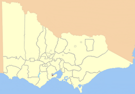 Location in Victoria, 1859 | |
| State | Victoria |
| Dates current | 1859–1877, 1976–1985 |
| Demographic | Urban |
Geelong East was an electoral district of the Legislative Assembly[1] in the Australian state of Victoria from 1859 to 1985. It was located south of the city of Geelong, defined in the Victorian Electoral Act, 1858 as:
Commencing at the north-western angle of the town reserve of Geelong; thence by a line south to the River Barwon; thence westward and northwestward by the River Barwon to the western boundary of the reserve at the junction of the Moorabool and Barwon; thence east by the northern boundary of section 25, parish of Barrabool; thence south by the eastern boundaries of sections 25 and 11, and by part of the eastern boundary of section 7, all in the same parish; thence south-easterly by a curved line crossing the Waurn Chain of Ponds to the southern boundary of section 3, parish of Conewarre; thence east by the southern boundaries of sections 3 and 4 in the same parish; thence north-easterly by a curved line crossing the River Barwon to the south-eastern angle of section 11 in the parish of Moolap; thence by the eastern boundary of that section and a line north to the shores of Corio Bay; and thence by the shores of Corio Bay to the north-western angle of the town reserve, the commencing point aforesaid, including the remaining portion of the reserve at Point Henry.[2]
Geelong East (along with Electoral district of Geelong West) was created when the four-member Electoral district of Geelong was abolished in 1859. Geelong West and Geelong East were abolished in 1877, replaced by a re-created 3-member district of Geelong.[1]
After the Electoral district of Bellarine was abolished in 1976, Geelong East was re-created. In 1985, population increases caused another redrawing of electoral boundaries; Geelong East was abolished and Bellarine re-created that year. Graham Ernst, last member for Geelong East, represented Bellarine 1985–1992.[3]
Members
| First incarnation (1859–1877, 2 members) | |||
|---|---|---|---|
| Member 1 | Term | Member 2 | Term |
| James Cowie | 1859 – 1860[r] | Alexander Thomson | 1859 – 1861 |
| Augustus Greeves | 1860[b] – 1861 | ||
| Butler Cole Aspinall | 1861 – 1864 | John Richardson | 1861 – 1876 |
| George Cunningham | 1864 – 1867 | ||
| Charles Kernot | 1868 – 1871 | ||
| John Masters Garratt | 1871 – 1877 | Charles Kernot | 1876[b] – 1877 |
Kernot went on to represent the re-created Geelong from 1877.[1]
| Second incarnation (1976–1985) | |||
|---|---|---|---|
| Member | Party | Term | |
| Phil Gude | Liberal | 1976–1979 | |
| Graham Ernst | Labor | 1979–1985 | |
Election results
References
- ^ a b c "Former Members". re-member: a database of all Victorian MPs since 1851. Parliament of Victoria. Retrieved 25 August 2022.
- ^ "An Act to alter the Electoral Districts of Victoria and to increase the number of Members of the Legislative Assembly thereof" (PDF). 1858. Retrieved 24 April 2013.
- ^ "Graham Keith Ernst". Re-Member: a database of all Victorian MPs since 1851. Parliament of Victoria. Archived from the original on 23 April 2023. Retrieved 24 April 2013.
- v
- t
- e
- Abbotsford
- Alberton
- Allandale
- Altona
- Anglesey
- Ararat
- Ascot Vale
- Avoca
- Ballarat
- Ballarat East
- Ballarat North
- Ballarat South
- Ballarat West
- Balwyn
- Barwon
- Belfast
- Benalla
- Benalla and Yarrawonga
- Bendigo
- Bennettswood
- Bogong
- Boroondara
- Borung
- Brunswick East
- Brunswick West
- Bulla
- Bulla and Dalhousie
- Buninyong
- Burwood
- Camberwell
- Carlton
- Carlton South
- Castlemaine
- Castlemaine and Kyneton
- Castlemaine and Maldon
- Castlemaine Boroughs
- Caulfield East
- Clayton
- Clifton Hill
- Clunes and Allandale
- Coburg
- Colac
- Collingwood
- Creswick
- Crowlands
- Dalhousie
- Dandenong and Berwick
- Dandenong North
- Daylesford
- Deer Park
- Delatite
- Derrimut
- Donald and Swan Hill
- Doncaster
- Doveton
- Dromana
- Dundas
- Dundas and Follett
- Dunolly
- Eaglehawk
- East Bourke
- East Bourke Boroughs
- East Melbourne
- Eastern Suburbs
- Elsternwick
- Emerald Hill
- Essendon and Flemington
- Evelyn and Mornington
- Ferntree Gully
- Fitzroy
- Flemington
- Forest Hill
- Frankston East
- Frankston North
- Frankston South
- Geelong East
- Geelong North
- Geelong West
- Gembrook
- Gippsland
- Gippsland Central
- Gippsland North
- Gippsland West
- Gisborne
- Glen Iris
- Glenelg
- Glenhuntly
- Glenroy
- Goulburn
- Goulburn Valley
- Grant
- Greensborough
- Grenville
- Gunbower
- Hampden
- Heatherton
- Heidelberg
- Horsham
- Jika Jika
- Jolimont and West Richmond
- Kara Kara
- Kara Kara and Borung
- Keilor
- Keysborough
- Kilmore
- Kilmore and Anglesey
- Kilmore, Dalhousie and Lancefield
- Kilsyth
- Knox
- Korong
- Korong and Eaglehawk
- Kyneton
- Kyneton Boroughs
- Loddon
- Lyndhurst
- Maldon
- Mandurang
- Maryborough
- Maryborough and Daylesford
- Maryborough and Talbot
- Melbourne South
- Mentone
- Mernda
- Midlands
- Mitcham
- Moira
- Moonee Ponds
- Moorabbin
- Mooroolbark
- Mount Waverley
- The Murray
- Murray Boroughs
- Murray Valley
- Noble Park
- Normanby
- North Grant
- North Grenville
- North Melbourne
- Numurkah and Nathalia
- Nunawading
- Ormond
- Ouyen
- Ovens
- Polwarth and South Grenville
- Polwarth, Ripon, Hampden and South Grenville
- Port Fairy
- Port Fairy and Glenelg
- Port Melbourne
- Portland
- Public Officers
- Railway Officers
- Rainbow
- Reservoir
- Ripon and Hampden
- Ripponlea
- Rodney
- Sandhurst
- Sandhurst South
- Sandridge
- Scoresby
- Seymour
- Shepparton and Euroa
- South Bourke
- South Grant
- South Melbourne
- South Yarra
- Springvale
- St Kilda
- Stawell
- Stawell and Ararat
- Sunshine
- Swan Hill
- Syndal
- Talbot
- Talbot and Avoca
- Toorak
- Tullamarine
- Upper Goulburn
- Upper Yarra
- Villiers and Heytesbury
- Walhalla
- Wangaratta
- Wangaratta and Ovens
- Wangaratta and Rutherglen
- Wantirna
- Waranga
- Warrenheip
- Warrenheip and Grenville
- Warrnambool
- West Bourke
- West Melbourne
- Westernport
- Whittlesea
- Wimmera
- Windermere
- Wonthaggi
- Yarraville
- Yuroke
38°09′45″S 144°21′30″E / 38.16250°S 144.35833°E / -38.16250; 144.35833


