Electoral district of Maldon
Former electoral district of the Victorian Legislative Assembly, Australia
Australian electorate
| Maldon Victoria—Legislative Assembly | |
|---|---|
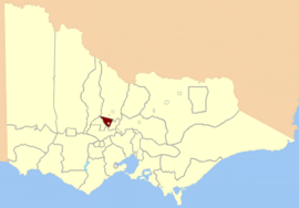 Location in Victoria | |
| State | Victoria |
| Created | 1859 |
| Abolished | 1904 |
| Namesake | Maldon, Victoria |
| Demographic | Rural |
The Electoral district of Maldon was an electoral district of the Victorian Legislative Assembly.[1]
Maldon was created in the expansion of the Assembly in 1859 by the Victorian Electoral Act, 1858.[2] Its area was defined by the Act:[a] and the River Loddon to Barker's Creek near Mount Prospect; thence on the east by Barker's Creek and Campbell's Creek to the River Loddon; and thence by the River Loddon to the commencing point, excepting the country included within the electoral district of Castlemaine.[2]
It was abolished by the post-Federation Electoral Districts Boundaries Act 1903[4] which took effect in 1904.
Members of Maldon
| Member | Party | Term | |
|---|---|---|---|
| George Harker | Unaligned | 1859–1860 | |
| James Martley | Unaligned | 1860–1861 | |
| John Ramsay | Unaligned | 1861–1867 | |
| William Williams | Unaligned | 1867–1874 | |
| James Service | Unaligned | 1874–1881 | |
| Sir John McIntyre | Unaligned | 1881–1902 | |
| William Wallace | Ministerialist | 1902–1904 | |
See also
- Parliaments of the Australian states and territories
- List of members of the Victorian Legislative Assembly
References
- ^ "Re-Member (Former Members)". Parliament of Victoria. Retrieved 29 December 2013.
- ^ a b "An Act to alter the Electoral Districts of Victoria and to increase the number of Members of the Legislative Assembly thereof" (PDF). 1858. Retrieved 29 December 2013.
- ^ "The Legislative Council Act 1881". Australasian Legal Information Institute. Retrieved 18 April 2014.
- ^ "Electoral Districts Boundaries Act 1903". Retrieved 28 December 2013.
- v
- t
- e
- Abbotsford
- Alberton
- Allandale
- Altona
- Anglesey
- Ararat
- Ascot Vale
- Avoca
- Ballarat
- Ballarat East
- Ballarat North
- Ballarat South
- Ballarat West
- Balwyn
- Barwon
- Belfast
- Benalla
- Benalla and Yarrawonga
- Bendigo
- Bennettswood
- Bogong
- Boroondara
- Borung
- Brunswick East
- Brunswick West
- Bulla
- Bulla and Dalhousie
- Buninyong
- Burwood
- Camberwell
- Carlton
- Carlton South
- Castlemaine
- Castlemaine and Kyneton
- Castlemaine and Maldon
- Castlemaine Boroughs
- Caulfield East
- Clayton
- Clifton Hill
- Clunes and Allandale
- Coburg
- Colac
- Collingwood
- Creswick
- Crowlands
- Dalhousie
- Dandenong and Berwick
- Dandenong North
- Daylesford
- Deer Park
- Delatite
- Derrimut
- Donald and Swan Hill
- Doncaster
- Doveton
- Dromana
- Dundas
- Dundas and Follett
- Dunolly
- Eaglehawk
- East Bourke
- East Bourke Boroughs
- East Melbourne
- Eastern Suburbs
- Elsternwick
- Emerald Hill
- Essendon and Flemington
- Evelyn and Mornington
- Ferntree Gully
- Fitzroy
- Flemington
- Forest Hill
- Frankston East
- Frankston North
- Frankston South
- Geelong East
- Geelong North
- Geelong West
- Gembrook
- Gippsland
- Gippsland Central
- Gippsland North
- Gippsland West
- Gisborne
- Glen Iris
- Glenelg
- Glenhuntly
- Glenroy
- Goulburn
- Goulburn Valley
- Grant
- Greensborough
- Grenville
- Gunbower
- Hampden
- Heatherton
- Heidelberg
- Horsham
- Jika Jika
- Jolimont and West Richmond
- Kara Kara
- Kara Kara and Borung
- Keilor
- Keysborough
- Kilmore
- Kilmore and Anglesey
- Kilmore, Dalhousie and Lancefield
- Kilsyth
- Knox
- Korong
- Korong and Eaglehawk
- Kyneton
- Kyneton Boroughs
- Loddon
- Lyndhurst
- Maldon
- Mandurang
- Maryborough
- Maryborough and Daylesford
- Maryborough and Talbot
- Melbourne South
- Mentone
- Mernda
- Midlands
- Mitcham
- Moira
- Moonee Ponds
- Moorabbin
- Mooroolbark
- Mount Waverley
- The Murray
- Murray Boroughs
- Murray Valley
- Noble Park
- Normanby
- North Grant
- North Grenville
- North Melbourne
- Numurkah and Nathalia
- Nunawading
- Ormond
- Ouyen
- Ovens
- Polwarth and South Grenville
- Polwarth, Ripon, Hampden and South Grenville
- Port Fairy
- Port Fairy and Glenelg
- Port Melbourne
- Portland
- Public Officers
- Railway Officers
- Rainbow
- Reservoir
- Ripon and Hampden
- Ripponlea
- Rodney
- Sandhurst
- Sandhurst South
- Sandridge
- Scoresby
- Seymour
- Shepparton and Euroa
- South Bourke
- South Grant
- South Melbourne
- South Yarra
- Springvale
- St Kilda
- Stawell
- Stawell and Ararat
- Sunshine
- Swan Hill
- Syndal
- Talbot
- Talbot and Avoca
- Toorak
- Tullamarine
- Upper Goulburn
- Upper Yarra
- Villiers and Heytesbury
- Walhalla
- Wangaratta
- Wangaratta and Ovens
- Wangaratta and Rutherglen
- Wantirna
- Waranga
- Warrenheip
- Warrenheip and Grenville
- Warrnambool
- West Bourke
- West Melbourne
- Westernport
- Whittlesea
- Wimmera
- Windermere
- Wonthaggi
- Yarraville
- Yuroke
36°59′30″S 144°4′0″E / 36.99167°S 144.06667°E / -36.99167; 144.06667


